Corfu Troumbettas
Misty panorama!
Corfu geography
Where is Corfu?
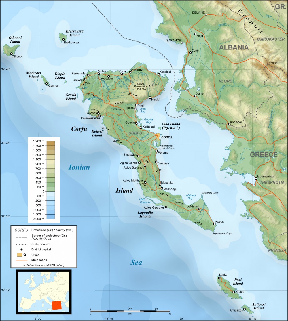
Corfu is located in the northwest of Greece and is separated by the Albanian and Greek mainland by the Corfu canal which, at its narrowest point, is less than 2 km wide. The island’s area is estimated at 588 sq.km. and is shaped like a sickle, wide at the north end and narrowing towards the south. The concave side, with the town and harbour of Corfu in the centre, lies toward the Albanian coast. Corfu is approximately 64 km long, with its greatest breadth at around 32 km. Corfu’s coastline spans 217 kilometres and its highest point is Mount Pantokrator (906 metres). There are two lakes , Korission and Antinioti, and four small rivers often dry in Summer at Potamos, Sidari, Messonghi and Lefkimmi.
Two high and well-defined ranges divide the island into three districts, of which the northern is mountainous, the central undulating, and the southern low-lying. The more important of the two ranges is that of Korakion Oros, the ancient Istone, which stretches east and west from Cape Falacro to Cape Psaromita, and attains its greatest elevation in the summit of Pantokrator (Παντοκράτωρ). The second culminates in the mountain of Hagioi Deka (Άγιοι Δέκα), or the Ten Saints.
The whole island, composed as it is of various limestone formations, presents great diversity of surface, and views from more elevated spots are magnificent. Beaches are found all around the island, with the most spectacular and less busy ones lying at the western coast.
Corfu is located near the Kefalonia geological fault formation but although earthquakes have occurred, unlike Cephallonia, Corfu town and countryside have not lost their traditional architecture from the 16th century.
The climate of Corfu is warm in the summer and damp in the winter with heavy rainfall. As a result, the whole island is green and covered with thick vegetation. The flora and fauna of Corfu are spectacular and vary from olive trees to pine forests, chestnut groves and thousands of wild flowers.